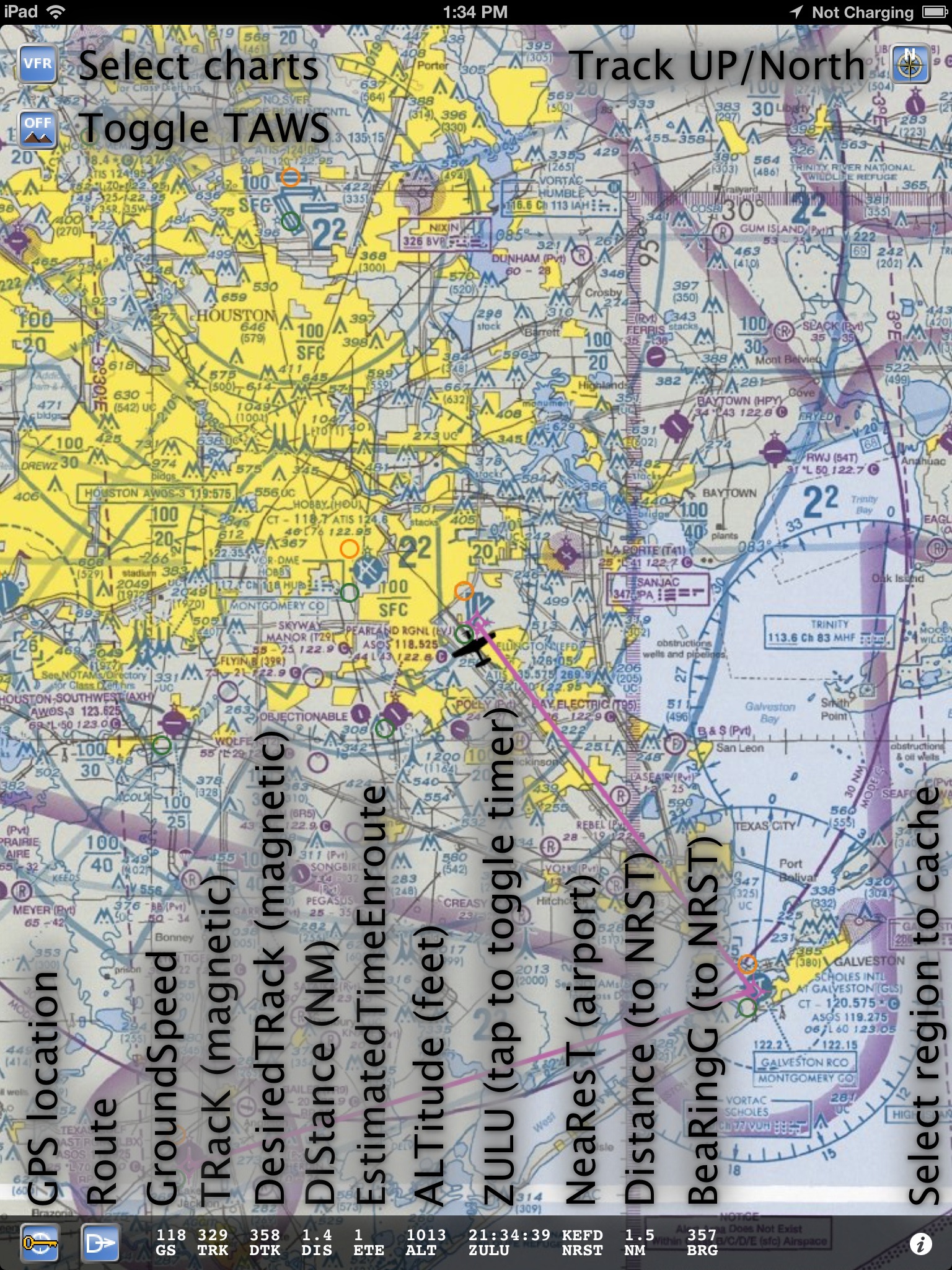
The buttons are clockwise from the upper right:
- Track UP/Map North – Select if map rotates with your direction of flight or if the airplane rotates on the map.
- ‘i’ button – Select what regions to download.
- Direct – you can enter a Direct fix here or enter a route.
- GPS location. Tap to enable a lock (indicated by a lock symbol). The map will now keep the display centered around the icon.
- TAWS – enable terrain. Terrain is displayed in red.
- Chart type select – the current chart you can view are:
- VFR – Classic aviation sectionals with WAC charts for extended coverage.
- TAC – Terminal Approach Charts, with border as intact as possible.
- FLY – The flip-side chart on the paper TAC charts. Also geo-referenced.
- IFR – Low enroute IFR charts.
- HFR – High enroute IFR chart.
- HLI – Helicopter VFR charts.
- GCW – Gulf Coast WAC VFR chart.
- GOM – Gulf Of Mexico IFR chart.
- WAL – Wall planning VFR chart.
The navigation data at the bottom of the screen:
- GS – Ground Speed in knots.
- TRK – Magnetic ground track.
- DTK – Desired magnetic track.
- DIS – Distance to next waypoint in NM.
- ETE – Estimated Time Enroute to next waypoint.
- ALT – Altitude in feet. Remember GPS altitude is always different from MSL.
- ZULU/TIMER/FlightTimer – Toggle the three different clocks by tapping on GS.
- NRST – Shows nearest airport with instrument approaches. Distance in NM and bearing to in magnetic degrees.